记录一次完整的Geoserver发布TIF文件
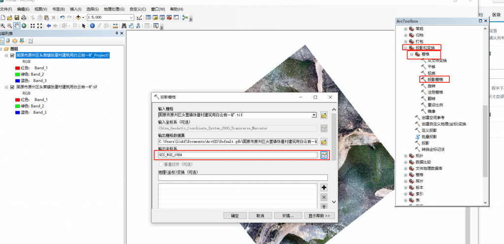
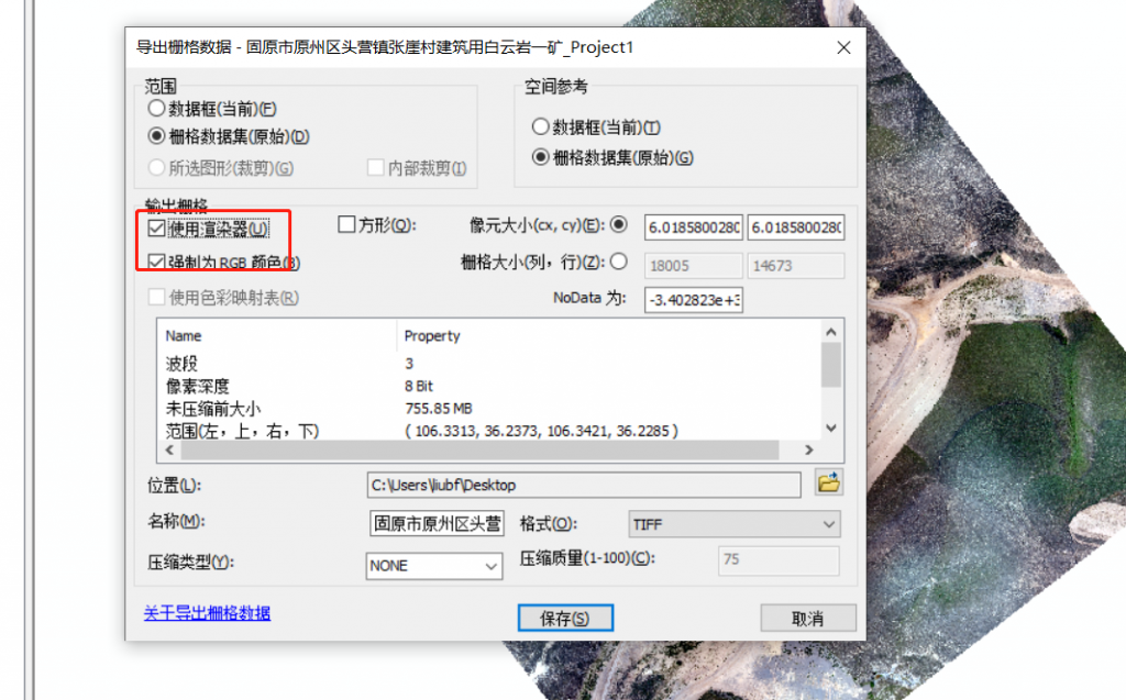
一. 需要在ArcMap中 先将tif进行转换和 使用渲染器到处


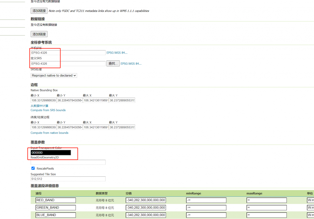
二.在geoserver发布的时候 需要设置透明色为000


PS: 原始数据为 (国内普遍的采集方式)
坐标系为:China_Geodetic_Coordinate_System_2000_Transverse_Mercator 投影坐标系: CGCS2000_3_degree_Gauss_Kruger_CM_105E EPSG:4544
本站文章除注明转载外,均为原创文章。转载请注明:文章转载自:
葱爆GIS—刘博方GIS博客(
https://liubf.com )